Complete Streets & Active Transportation
Overview - What is a Complete Street?
The National Complete Streets Coalition defines complete streets as, “streets for everyone [that] are designed and operated to enable safe access for all users, including pedestrians, bicyclists, motorists and transit riders of all ages and abilities. Complete Streets make it easy to cross the street, walk to shops, and bicycle to work. They allow buses to run on time and make it safe for people to walk to and from train stations.” Active transportation is a term used to refer to human-powered mobility options and includes walking, biking, electric-biking, scootering, and more.
Measuring Complete Streets
In 2014 CRCOG developed its first Active Transportation Audit to gather information and rate key intersections for bicycling and walking in the region. An audit is available for roadway intersections and for trails. The audits are easy to complete and are designed for communities to use on their own as well as for use in the regional bike ped count program.
Planning for Active Transportation
In 2016, CRCOG was awarded a grant of technical assistance from the National Association of Chronic Disease Directors to attend the Step it Up! Walkability Action Institute. CRCOG took an interdisciplinary team including expertise in the areas of transportation, planning, public health and an elected official. The team produced a 5-goal Action Plan to Increase Walking and Walkability.
As part of its overall transportation planning responsibilities, CRCOG is responsible for developing the region’s Pedestrian and Bicycle Plan. The 2020 CRCOG Complete Streets Plan includes a 2021 update. Work is currently underway on Priority Pathways: A Bicycle and Pedestrian Network for the Capitol Region that will complement the Complete Streets Plan.
Executive Summary
Full Study Report
CRCOG Micromobility Webpage
The Greater Hartford Transit District and the Capitol Region Council of Governments worked with a consortium of agencies to investigate the feasibility of implementing bike share in the Hartford region and in locations outside the region, including Waterbury. The study’s final report lays out a phased plan for implementation of a regional bike share system.
Ongoing Projects & Programs
The purpose of this study is to develop a vision and create an implementation plan for a regional bicycle and pedestrian network. The network will meet bicycle and pedestrian Levels of Traffic Stress 1, serve utility AND recreational cyclists and pedestrians, build on previous efforts, and connect to local bicycle and pedestrian infrastructure. CRCOG expects that the network will emphasize facilities that are physically separated from vehicular traffic.
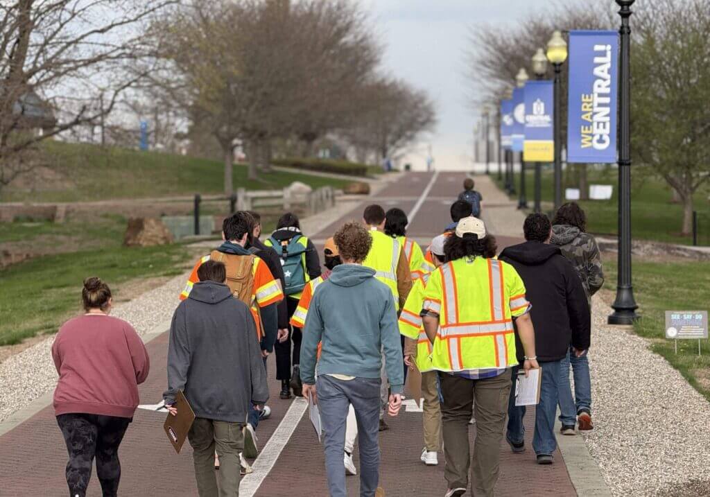
CRCOG has begun to program walk-audits that give the opportunity for stakeholders to walk or ride through the spaces and corridors that make up the Capitol Region, taking note of the infrastructure that needs enhancement and investment. CRCOG staff has produced a series of story-maps detailing the observations of these walk-audits.
LOTCIP is a great resource to provide bike and pedestrian improvements to existing or new roadways, or in other words, complete your street. The program provides State funds to municipal governments for transportation projects, including sidewalk installation, intersection improvement, and multi-use trail projects.
Complete Streets Plan & Policy
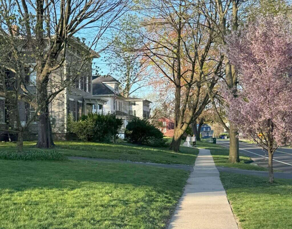
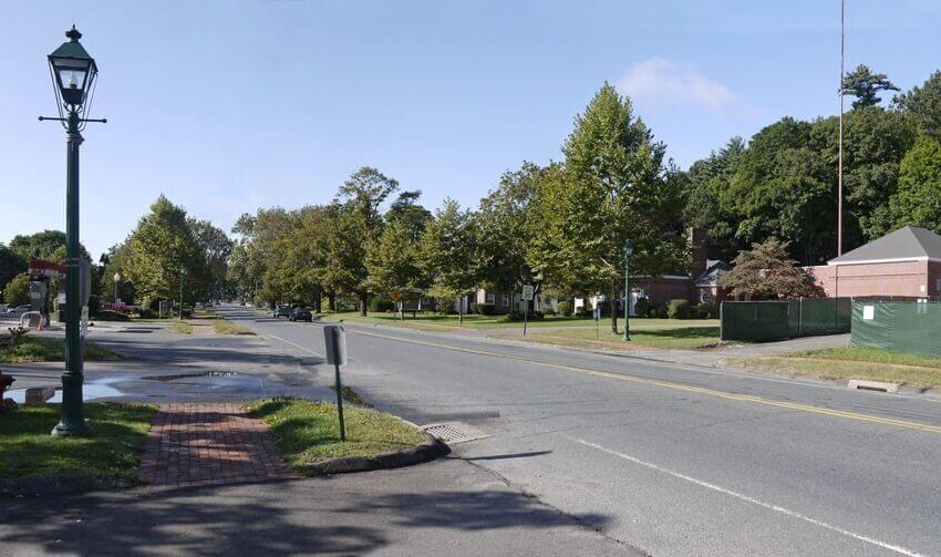
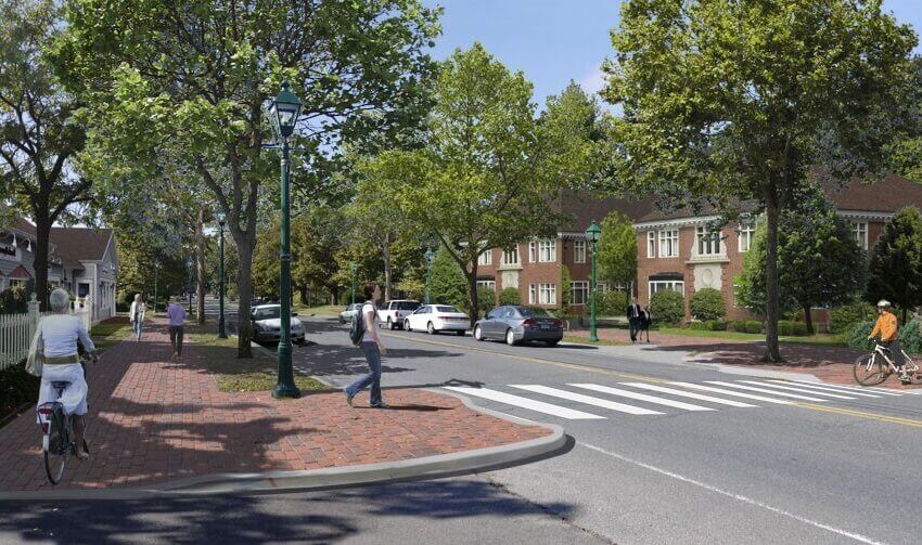
More than anything, a street should be a safe space for all. The Capitol Region’s streets are public space, and they should be more than just where we travel—they should be where we gather, play, socialize, celebrate, and trade. For most of history, streets had these many purposes. It wasn’t until about one hundred years ago, we stopped prioritizing this variety of purposes, with people at the center, in favor of something more singular: the fast and uninterrupted movement of automobiles.
The Complete Streets plan provides recommendations for reversing that trend. As a companion to this plan, the Capitol Region Council of Governments (CRCOG) has developed a regional complete streets policy. This policy makes complete streets a requirement of funding programs administered by CRCOG. It also recognizes that the trend over the past 100 years has been to prioritize the automobile, to the detriment of other users, in effort to reverse this trend.
Local Transportation Capital Improvement Program (LOTCIP)
Connecticut Public Act 13-239 was signed into Law in June 2013, directing the Connecticut Department of Transportation (CTDOT) to create a state funded Local Transportation Capital Improvement Program (LOTCIP). The program provides State funds to municipal governments through Council of Governments (COG’s) for transportation projects of regional significance, including reconstruction, pavement rehabilitation, sidewalk, bridge, intersection improvement, and multi-use trail projects. Since 2014, the State has consistently allocated between $45 and $74 million annually for LOTCIP. As of July 2023, over $550 million has been budgeted for LOTCIP statewide, including over $203 million for the CRCOG region.
LOTCIP is a great resource to provide bike and pedestrian improvements to existing or new roadways, or in other words, complete your street. Learn more about the LOTCIP program by visiting the LOTCIP webpage or check out the Complete Streets Compliance form and Application that go with the LOTCIP program below.
Capitol Region Walk Audit Program
The best way to understand space is by being in that space. Getting out from behind the desk and onto the streets, sidewalks and bus routes residents use every day is just as important as filing the right paperwork for a grant application. In 2024, CRCOG has begun to program walk audits. These walk audits give the opportunity for stakeholders to walk or ride through the spaces and corridors that make up the Capitol Region, taking note of the infrastructure that needs enhancement and investment. Following the walk audit, CRCOG staff produces a storymap in coordination with municipal staff that gives an overview of the observations and notes taken by the group while on the walk audit. This product can be used to apply for grants and can act as an outline for what improvements need to be made to the site visited.
Visit the walk audit webpage to view existing storymaps and learn more about the program below.
CT Quick Build Materials Guide
This document provides guidance on a range of materials suitable for implementing eleven types of Tactical Urbanism/Quick-Build projects within the public right-of-way. The Guide is intended to help planners, political officials, and advocates engage their communities, test temporary or interim street design treatments, and deliver public space enhancements for community use.
Tactical projects effectively bridge the void that exists between unsatisfactory current conditions and the delivery of long-term capital investments, while delivering low-cost public safety and accessibility benefits in the near-term.
Bicycle Pedestrian Committee
The Bike-Ped Subcommittee Meetings are held quarterly on the second Tuesday of the month. These meetings are a space to share updates on bicycle and pedestrian topics throughout the region and are open to the public.
Vision Zero and Regional Transportation Safety Plan
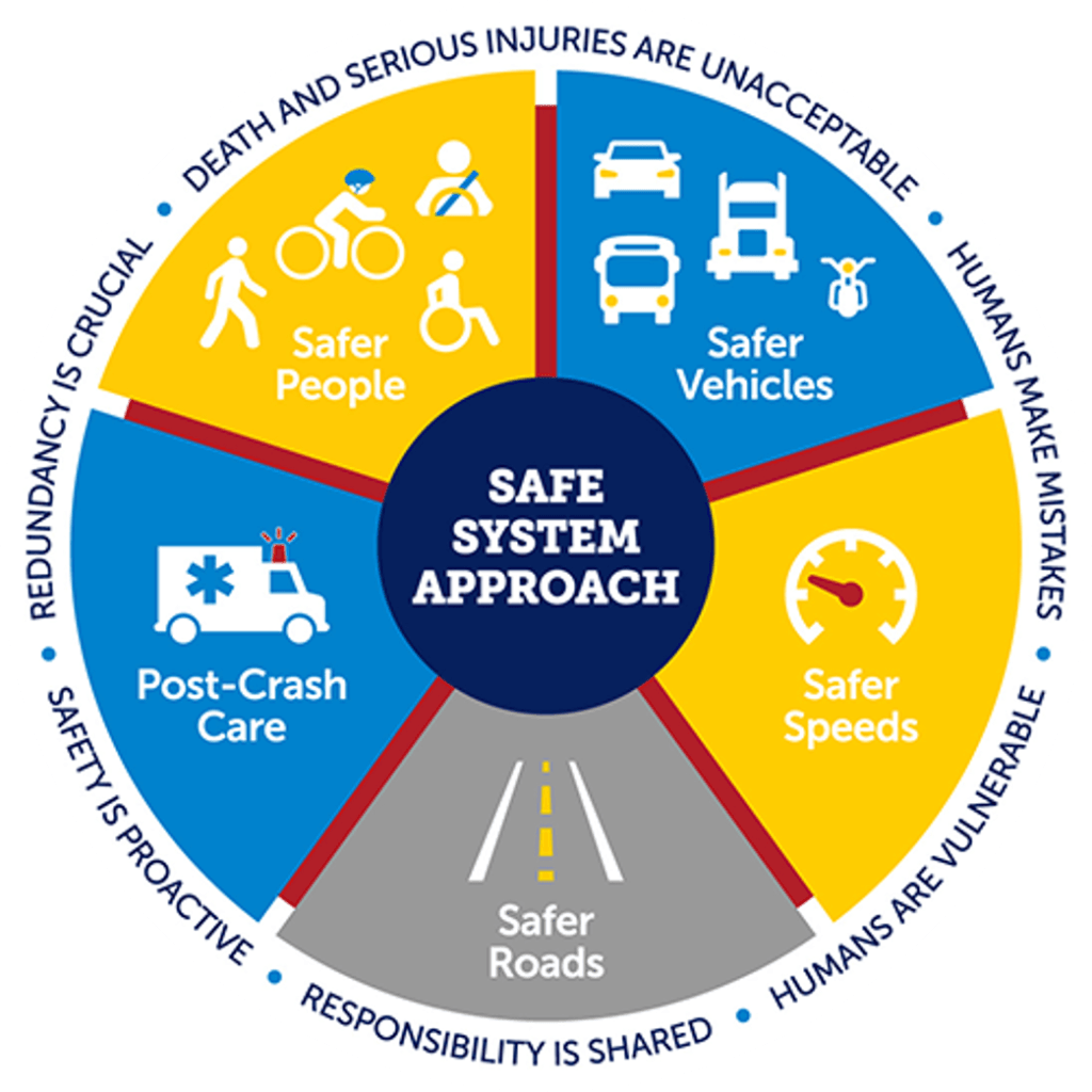
Vision Zero is a strategy related to Complete Streets. The Vision Zero Network defines the concept as “a strategy to eliminate all traffic fatalities and severe injuries, while increasing safe, healthy, equitable mobility for all.”
Vision Zero starts from the premise that all traffic related deaths and serious injuries are “preventable” and that some level of human failure is inevitable. With Vision Zero, designers incorporate a systems-based approach to prevent fatal and severe crashes.
To assist with Vision Zero efforts in the Capitol Region, CRCOG has received a USDOT Safe Streets and Roads for All (SS4A) grant to supplement the Regional Transportation Safety Plan for the CRCOG region. The new federal SS4A grant program takes steps to formalize the Safe System approach in local safety planning documents through its Comprehensive Safety Action Plan (Action Plan) requirements. The Action Plan requirements are important now, because CRCOG municipalities seeking future SS4A implementation grant funds require an Action Plan. View the SS4A project page below to learn more.
Land-Use & Zoning for Complete Streets
Think about that perfect boulevard. That street that makes you say “I’m going to go this way instead” because of how pleasant the experience is walking down that sidewalk or even driving under the comforting canopy of a treelined street. Beyond the street, what else is there?
A complete street also invites activity on its sidewalks by having its buildings oriented toward the street. Storefronts are easy to peer into as you pass by, and front doors are close to the sidewalk to facilitate neighborly connections. Taller residential clusters have porches and balconies to have a less abrupt transition of activity from the horizontal plain of the street to the vertical plain of the building facade. With buildings oriented toward the street, with limited setbacks and varying building heights, a sense of enclosure is created for the streetscape. A sense of enclosure is the feeling of comfort and security brought from being in a defined space created by surrounding buildings, trees or other vertical elements. This is a key aspect to a sense of place and a streetscape that supports active transportation. Ensuring your municipality’s zoning has limited setbacks, allows for varying building height, offers a mix of building-uses along main corridors, and at least allows for some density to foster a sense of enclosure are essential for creating a healthy network of complete streets that facilitate active transportation.
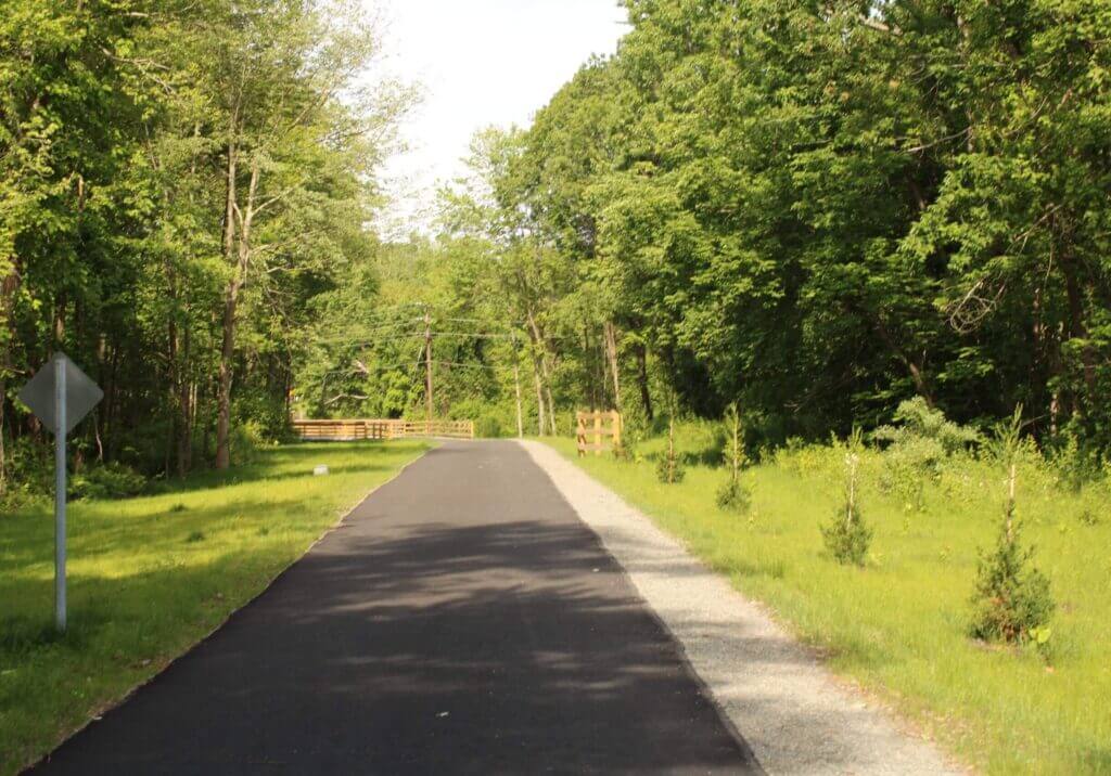
Trails in the Capitol Region

The East Coast Greenway is a trail that runs from Maine to Florida, with 200 miles of that trail running through Connecticut. Visit the East Coast Greenway website for more information or check out the East Coast Greenway Gap Closure study to see ongoing work on the Greenway.
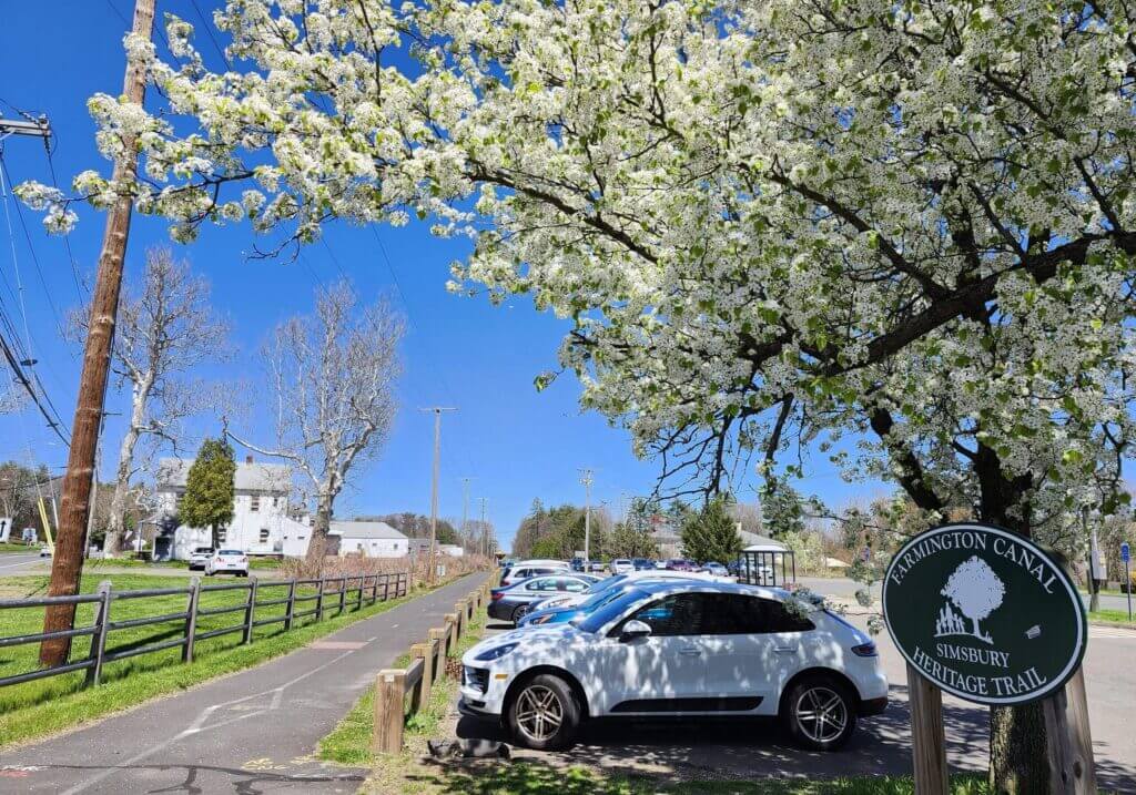
The Farmington Canal Heritage Trail is a 56-mile trail that runs through the Capitol Region. Visit the Farmington Canal Heritage Trail and Farmington River Trail website to learn more.
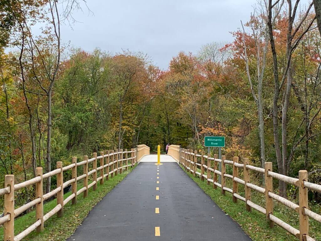
The Hop River Trail is a trail that spans across twenty miles of retired railroad line; through the towns of Manchester, Vernon, Bolton, Coventry, Andover, and Columbia. Visit the CT Parks website for more information on this trail as well as directions or learn more about the Route 6 Corridor and related trail gap closures by visiting the Route 6 Hope River Corridor Study webpage.
Resources & Funding
Please see state and other resources linked below.
Plans & Studies
Please see other relevant plans and studies linked below.
more plans & studies
Questions?
For information on the Complete Streets Work in the Capitol Region contact:
Caitlin Palmer
Director Of Regional Planning & Development
860 724 4435